Welcome Inspire Pilots!
Join our free DJI Inspire community today!
Sign up

How High for 20 acres

Joined
Oct 6, 2015
Messages
11
Reaction score
0
Age
71
Not good at math. Expect someone can work this out in their sleep.

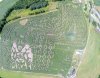
Question is if I was going to photograph a 20 acre parcel. Including the whole parcel in one photograph how high would I have to be with my Inspire 1 (original)?
Assumptions: Parcel is square and parcel is flat. You are looking straight down at the parcel.

Extra credit: how high for a 10 acre parcel?

Any help appreciated.
 
It would need to be othorectified for it to be square with the stock lens. Better using MapPilot with muliple photos. Just draw the parcel on the map, set your height and you are good to go. Its interactive so the flight grid will vary in size depending on what height you set. Then othorectify them in the likes of Photoscan or Px4d.

Maybe this is over kill for what you want?
 
  • Like
Reactions: Yiannis.B
It would need to be othorectified for it to be square with the stock lens. Better using MapPilot with muliple photos. Just draw the parcel on the map, set your height and you are good to go. Its interactive so the flight grid will vary in size depending on what height you set. Then othorectify them in the likes of Photoscan or Px4d.

Maybe this is over kill for what you want?
Thanks for the quick reply and great answer.

I should have been a bit more forthcoming. I get a reasonable number of calls from residential property owners who have 10-20+ acres and their first question is usually can you get the whole property in? My typical response is, probably not, depends on lay of the land and such. I'm really looking for a reasonably accurate answer I can give them to illustrate why, in most circumstances I can't do their whole property in one shot, at least not without flying out of sight.

MapPilot sounds like a great solution, and something to explore, but these are typically owners who want to pay the minimum and are doing it to have something to hang on their wall. So time spent becomes a major factor.

From your description MapPilot would be a good choice for the picture we took today which is actually a panorama put together from a number of shots. You can definitely see the distortion at the edges. Would be much better to eliminate the distortion.
 

Attachments

  • panomaze-1.jpg
    panomaze-1.jpg
    1.5 MB · Views: 70
Here's a screen grab from the last time I flew with MapPilot. Your height is sorta defined by how detailed you need the final map. I flew around 130' to get 10 acres.

- This is based on a mosaic stitched together. To get 10 acres in one frame I'd guess 180-200' straight overhead. Much lower if you photograph off to the side.
 

Attachments

  • IMG_1200.PNG
    IMG_1200.PNG
    2.5 MB · Views: 85
  • Like
Reactions: Yiannis.B
I live on 200+ acres and you can easily get it all in one shot, especially if you angle it from an edge. The problem is that you have to resolving/zoom power on the image. If you really want to try to make some income from doing this sort of work, I'd suggest that you do what has been suggested above and take multiple shots and stitch them together. The quality is going to be so much better that way.

Yes. You can EASILY get 10-20 acres in with a simple overhead, but you wouldn't want to do it.
 
  • Like
Reactions: Yiannis.B
Looks cool. So besides the $10 for the app are you using their service to process the images or do you have another program? If using them what does it cost to get processed?
Would love to see the final result.
One problem I could see in our area are parcels On a mountainside. The highest point might be several hundred, or a thousand feet above the elevation of the low point on the property.
 
To answer original extra credit question, how heigh to photograph 10 acres looking straight down.

10 acres is 660 x 660 feet for those not used to furlongs and chains :)

Converting 10 acres to a 4x3 format to match camera is 762 ft x 571 ft

DJI 15mm is 72 degrees diagonal Field of View.

Therefore to get it all in you would need to be 655 ft up. My usefull rule of thumb is, as far away as wide.

and for 20 acres 917 ft

Hence why you definitely need to photograph at an angle or use a mosaic.
 
20 acres squared is roughly 4.5x4.5.
An acre is 208'x208'. 208x4.5= 940'x 940'
Assuming it is an X3 camera with a 94 deg field of view with a 4x3 aspect ratio you would divide the width of the coverage area by .75 = 1,253 (to compensate 25% for the shorter aspect) and multiply that by .71 (half the longest diagonal distance of a square) and that should get you in the neighborhood of the altitude necessary to get it all in one shot. 1253 x .71= 890'

Thx for posting this. Has anyone actually written a formula? I know I'll need it someday.
 
Thx for posting this. Has anyone actually written a formula? I know I'll need it someday.

That is pretty much the formula for a roughly 90 deg field of view camera lens. The multiplier for the diagonal of a square is 1.414 and half of that which would be the necessary altitude to capture the FOV for a 90 deg lens is .71.
 
Diagonal of a 4x3 aspect ratio field would be;

y = sqrt ( 660 * 60 * #acres * 25/12)

Height to include the diagonal would be;

height = y /( 2 tan ( FOV /2 ))

where FOV is the field of view of the lens
 
  • Like
Reactions: Pescatoral Pursuit
I've just started playing with this on our 20 acre property. Ours is very long and narrow ~900m x 100m, so the 4 x 3 aspect is not relevant to the size. If I wanted to get it all in a single shot with the X3, by my calculations, I'd have to be at about 420m altitude (not happening), but to get in just the width, I can do it at an altitude of just under 50m. The only way to do it sensibly is to stitch it together. One tool that I'm currently playing with is Microsoft ICE. It can convert a video to a panorama, and I've found that flying with the camera pointed straight down does yield a reasonable planar image (alternately hovering and rotating the camera gives a decent spherical 'fisheye' type shot... the one below was shot at 70m)
13767198_10157195395385578_5401363277919197838_o.jpg
 
  • Like
Reactions: Pescatoral Pursuit
To answer original extra credit question, how heigh to photograph 10 acres looking straight down.

10 acres is 660 x 660 feet for those not used to furlongs and chains :)

Converting 10 acres to a 4x3 format to match camera is 762 ft x 571 ft

DJI 15mm is 72 degrees diagonal Field of View.

Therefore to get it all in you would need to be 655 ft up. My usefull rule of thumb is, as far away as wide.

and for 20 acres 917 ft

Hence why you definitely need to photograph at an angle or use a mosaic.

Thanks. That is the sort of answer I was looking for. I wanted a way to communicate the situation to the "casual" client who asks if we can show their whole property in on photo. In our heavily wooded State if people are looking to show all the features of a property you often have to be looking almost straight down to see buildings and such.
 

New Posts

Members online

Forum statistics

Threads
22,290
Messages
210,728
Members
34,483
Latest member
cruzamikayla